Mobile 3d Laser Scanning
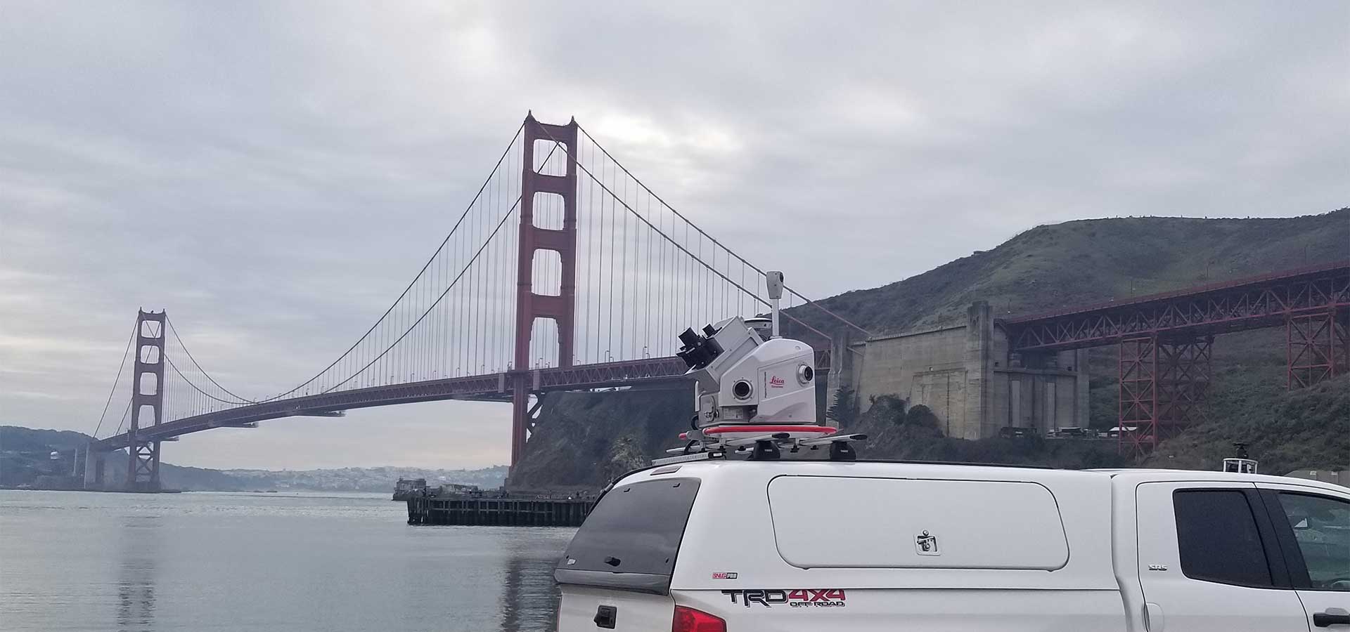
Mobile Laser Scanning is an emerging technology employed to rapidly and efficiently capture accurate and highly-dense three-dimensional data and high-resolution imagery of roadways, city infrastructures, transmission lines and transportation corridors, including highway and railway assets. Castañeda Engineering is one of very few engineering firms worldwide, and the only forensic engineering firm in North America, which possesses a mobile vehicle-mounted dual-laser scanner system. Whereas static laser scanners capture scan data from a fixed location, our Mobile Laser Scanning System is mounted atop our work truck and can capture high-resolution imagery and accurate three-dimensional data at rates of up to 2 Million points per second – all while the vehicle is in motion.
The high data capture rate of our mobile laser scanning system facilitates 3D digitization of Highways, Interstates and busy thoroughfares while driving alongside traffic at highway speeds without the need for roadway closures or traffic control. This is especially beneficial when scanning roadways with heavy traffic and sites where static laser scanning and UAS (drone) operations are not practical, achievable or permissible. Whether scanning a major highway traversing a metropolitan area for accident reconstruction or mapping transportation corridors to complement surveys, as-builts or management of assets, we can help. Give us a call to discuss custom-tailored services and deliverables for your project.
sites digitized with our mobile 3D laser scanning system
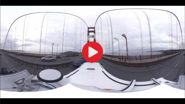
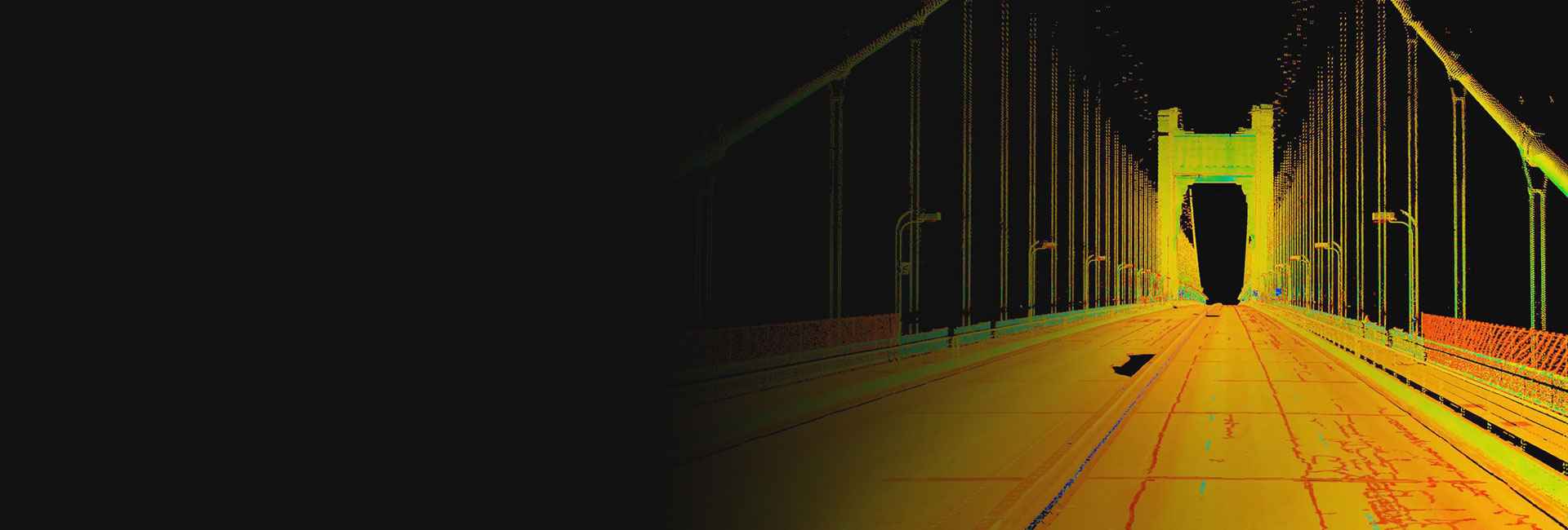
Golden Gate Bridge
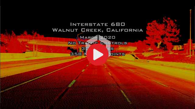
I-680 Walnut Creek, CA
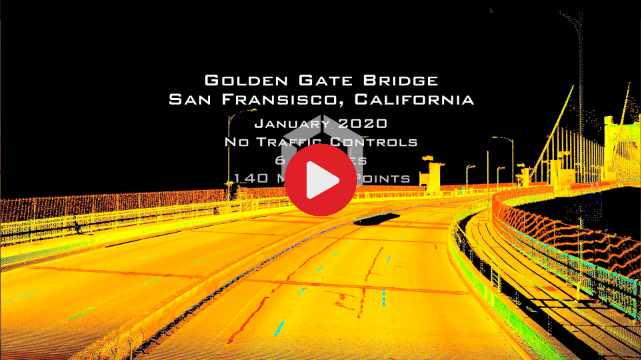
Golden Gate Bridge
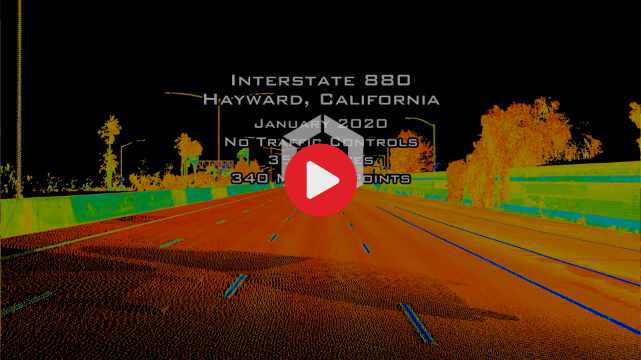
I-880 Hayward, CA
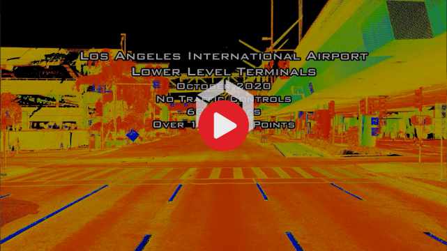
LAX
we can help
Whether its scanning a major highway traversing a metropolitan area for accident reconstruction, documenting corridors to complement surveys, as-builts or management of assets, we can help. Give us a call to discuss custom-tailored services and deliverables for your project.